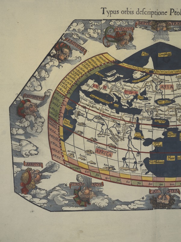
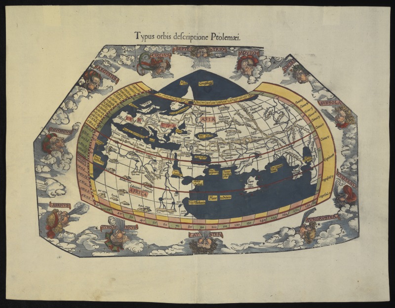
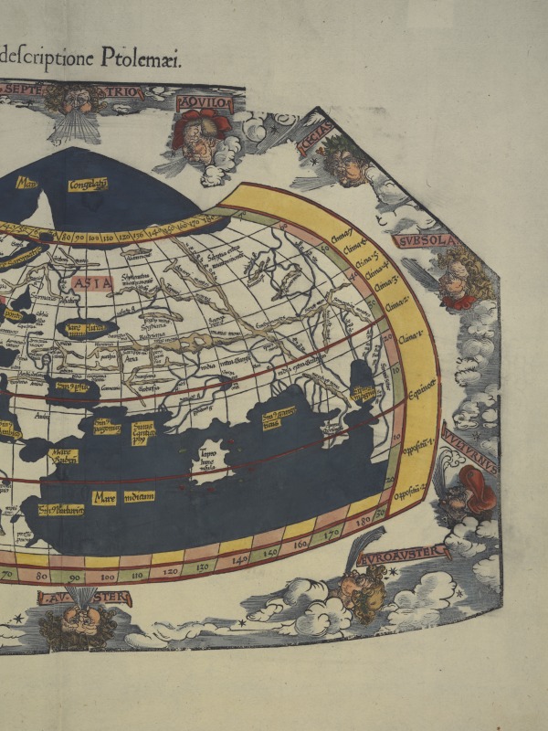
Map titled 'Typus orbis descriptione Ptolemaei', by Gaspar Treschel, Vienna, 1541
View this record on the National Museum of Australia's website
Sign in to save favourites.
- Type
- Maps
- Date
- 1541
- Place
- Vienna, Austria; Alexandria, Egypt; Europe; Africa; Indian Ocean; Mediterranean Sea; Java, Indonesia, Asia; Middle East
- Materials
- Ink, Paper
- Collection
- Typus Orbis Descriptione Ptolemaei Map collection
- Accession number
- 2007.0038.0001
Description
Woodcut map, hand-coloured, representing a version of Ptolemy's world map. The portion of the world shown includes the top half of Africa, Europe and part of Asia. The globe projection is encircled by twelve wind heads, each surrounded by clouds. The number "27" is stamped on the reverse of the map in black ink.
About the collection
The 'Typus Orbis Descriptione Ptolemaei' Map collection consists of one hand-coloured woodcut map of the world as known in the time of Ptolemy (150 AD) and produced in Vienna in 1541 by Gaspar Treschel. The map is in good condition. Until HMB 'Endeavour' returned to Britain from her voyage to the South Seas in 1771, the Pacific Ocean was much speculated upon, but little known. Theories about the region dating from the Classical era had been given their most authoritative form in the maps of Claudius Ptolemy, and the renewed popularity of his world map in the 1400s restored hopes that a Great South Land might exist. 'Typus Orbis Descriptione Ptolemaei' records the limits of knowledge about world geography as the first European voyages of discovery set out in the 15th century. The charts from these voyages were incorporated into Ptolemy's world map, combining new discoveries with ancient myths. It would not be until 1775 that Cook's second voyage finally proved the myth of the Great South Land false.
Read live from the Museum's Collection API (12/11/2026, 5:44:37 am). Record last updated by the Museum 2025-07-28. Licence: https://creativecommons.org/licenses/by-nc/4.0/.